The Unified Ground Control Station (UGCS) software application provides a unified Uncrewed Aircraft System (UAS) command and control interface that seamlessly scales across different hardware devices, operating systems, (Windows, Linux, and Android) and display resolutions. The underlying software is based on the non-proprietary, open, uncrewed systems control segment, and the interface between the UGCS and uncrewed aircraft is STANAG 4586 compliant. The UGCS contains a host of user-friendly features designed by UAS operators and human-factors experts. It has flown everything from small quad-rotors to a large uncrewed Black Hawk® helicopter – including several tactical fixed-winged and Launched Effects (LE) platforms. It supports these standards: STANAG 4586, MAVLINK, RAS-A, and RAS-G.
The UGCS integrates with numerous internet protocols, as well as point-to-point and mesh radio systems, including Government-Off-The-Shelf (GOTS) radios (L3 Rover 6™, Cubic MMT™) and Commercial-Off-The-Shelf (COTS) radios (Wave Relay™, Silvus™).
The UGCS-C meets international STANAG 4586 standards and supports the open-source MAVLINK protocol. This version is widely utilized by foreign governments and commercial customers due the commercial commodity jurisdiction established by the U.S. Department of State.
The UGCS-D meets international STANAG 4586 standards and supports U.S. military Interoperability Profiles (IOPs). This product is primarily utilized by the U.S. Department of Defense due to ITAR restrictions regarding U.S. military IOPs.
| Foundation: |
|---|
| • Exportable (UGCS-C) |
| • DO-178C certifiable architecture |
| • Army STANAG IOP compliant (UGCS-D) |
| • VSMs (i.e. Piccolo, MAVLink, Kestrel, etc.) |
| • OS independent (Linux, MS Windows, CentOS) |
| • Open, non-proprietary Interfaces based on UCS |
| • LOI 2, 3, 4 (MUM-T & Class C CUCS), 5 (Class A & B Handoff) |
| • Embedded air vehicle & video simulation & training capability |
| • Supports fixed-wing, quad-rotor, VTOL, air-launched |
| Multiple Payload Control Options: |
|---|
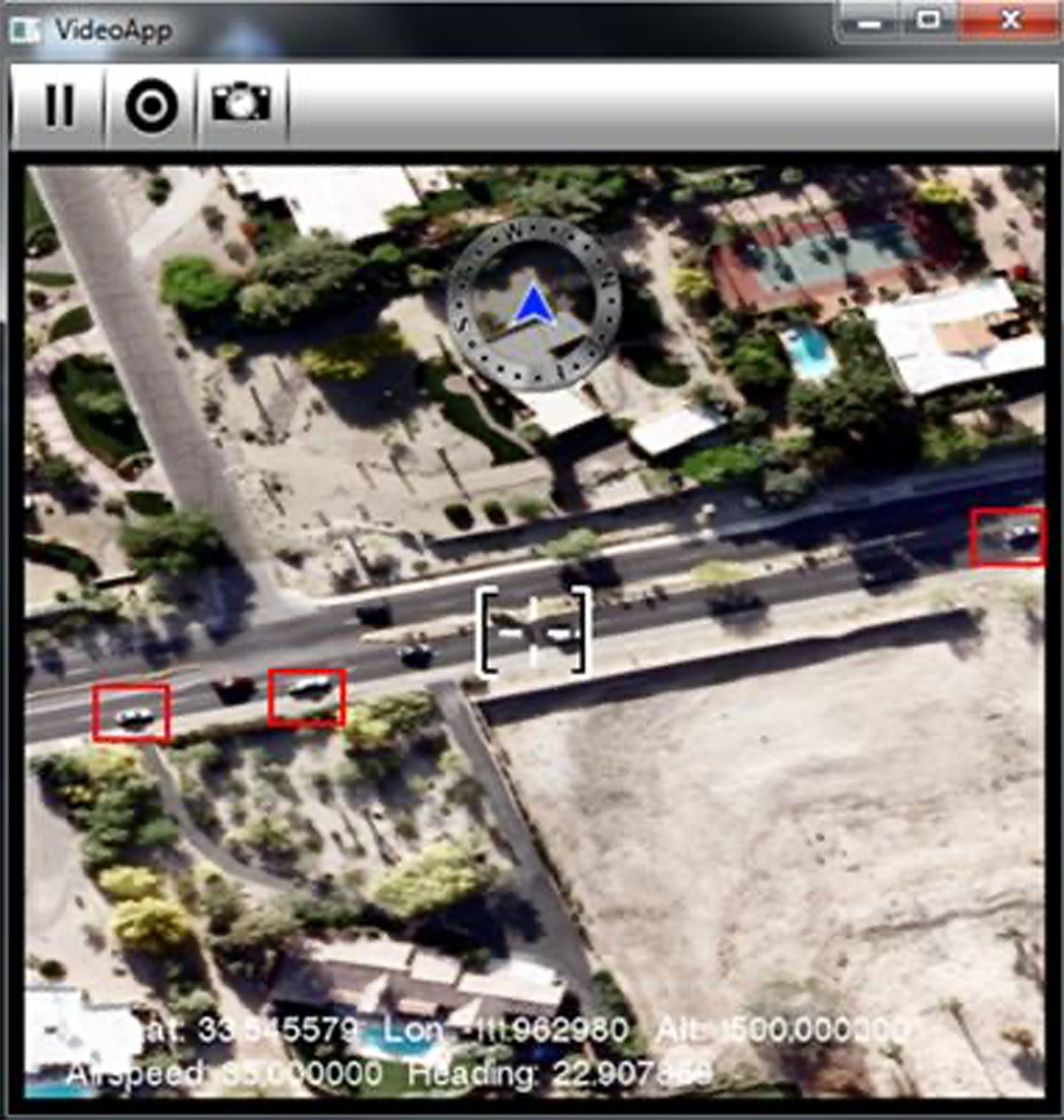
| • EO/IR pan, tilt, zoom |
| • Laser pointing & designation |
| • Center Field of View (FOV) coordinates |
| • Snap geo-rectified photo with metadata |
| • MGRS & latitude & longitude coordinates |
| • Point & click coordinates in video window to slew |

| Features: |
|---|
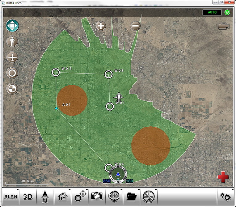
| • 2D/3D displays |
| • Heads-up displays |
| • 3D sensor footprint |
| • Pre-mission planning |
| • DO-178-C auto-routing |
| • Safe multi-UAS control |
| • 2D AGL vertical profile |
| • Color-coded flight legs |
| • Warnings, cautions & alerts |
| • Radio frequency line of sight analysis |
| • Autonomous multi-vehicle teaming |
| • Terrain & no-fly zones avoidance |
| • Waypoint planning (add, edit, delete, airspeed, altitude MSL/AGL) |
| • Autonomous route & area search based on NIIRS Rating |